Glenwood Canyon: An I-70
Odyssey
History of the Canyon and Construction of I-70
![]()
![]()
![]()
![]()
![]()
![]()
Early Canyon History
Glenwood Canyon was formed by the Colorado River -- called the Grand River up through the early 20th Century -- as it carves its way through the granite of the Rocky Mountains. The canyon is about 16 miles of steep to sheer cliff sides rising on either side of the river, with intermittent creeks and small canyons branching off from it.
Captain Richard Sopris led a surveying and prospecting expedition to the area in 1860, and in 1879 Fort Defiance was established at the junction of the Grand and Roaring Fork Rivers. In 1883, Sarah, wife of resident Isaac Cooper, had the town renamed because she disliked Defiance. The town was renamed Glenwood Springs, after Sarah's hometown of Glenwood, Iowa. Glenwood Springs was incorporated in August 1885.
The Denver and Rio Grand Railroad (DRGRR) proposed a rail route through the area in 1870 and decided to build it in 1885. It would require new construction from Leadville west to Grand Junction, and would take advantage of the boom in Aspen mining and coal near Glenwood Springs. The line was built along the south side of the river through the canyon, and construction was complete west to Glenwood Springs in October 1887.
In 1935 the "Dotsero Cutoff" was complete, which linked the DRGRR line through the canyon to the Denver and Salt Lake Railroad and the Moffat Tunnel (completed in 1928). In 1983, Amtrak stopped using the Wyoming routing for its California Zephyr line and routed it along the DRGRR line through Glenwood Canyon. In 1984 the DRGRR was sold to Denver billionaire Phil Anschutz, and in 1988 was combined with Southern Pacific. In 1995 SP was sold to Union Pacific (UPRR).
Rapid development occurred in the canyon with the start of construction of the Shoshone Power Plant in 1906. The plant began generating power in June 1909. Water is diverted out of the Colorado River at Shoshone Dam, travels through a 16' wide by 12' high diversion tunnel in the canyon wall, then exits the canyon wall and into the plant. The water has a fall of 287', and the plant's two generators are capable of producing 15 MW. The plant was built by Central Colorado Power Company and sold to Public Service Company of Colorado (now Xcel Energy) in 1924.
Pre-Interstate Roads
When Colorado got into state highway road building in the early 20th Century the road through the canyon became part of SH 4. When the US Highway routes were developed in 1926, the route through Glenwood Canyon was proposed to be part of US 46, but that highway was scrapped and it instead was part of US 40S when the routes were implemented in 1927. In 1936 US 40S was renumbered to be part of US 24. Then in 1937 US 6 was lengthened westward from Denver and was comarked with US 24 through Glenwood Canyon. In the 1920s the roadway through the canyon was only graded and graveled, but during the Depression U.S. Representative Edward Taylor obtained $1.5 million for widening and paving of the canyon road. The improvements were opened August 1, 1938.
US 6-24 through Glenwood Canyon remained pretty much unchanged until the 1960s. In 1960 the federal government approved a proposed extension for I-70 to go west from Denver to Utah. The first divided section of highway was complete in 1965, and went from Glenwood Springs east to No Name. This included the two bores for the No Name Tunnels and bypassed the Horseshoe Curve section of the canyon. East of the canyon (Dotsero) I-70 was built by 1982, but the section from No Name to Dotsero would be the most troublesome to complete.
Heading Toward Construction
Environment and citizen opposition quickly developed to the idea of building a large, standard freeway through the canyon. The Colorado Department of Highways (CDH) studied two other main alternatives for the routing of I-70:
- Cottonwood Pass. From Gypsum go southwest over the pass to SH 82 near Carbondale, then northwest to Glenwood Springs.
- Flat Tops. Route I-70 to the north of Glenwood Canyon through White River National Forest wilderness.
Both alternatives were rejected due to the costs, distances, and severe winter weather which would constantly close the roads. Stuck with having to put I-70 through Glenwood Canyon, the public developed a "do it right" attitude. In 1968 the Colorado Legislature passed a non-binding resolution directing CDH to make the highway a "tasteful blend between 'the wonders of human engineering' and the 'wonders of nature'" [1].
In 1972 CDH retained three separate firms for $100,000 each to begin preliminary design on three separate alternatives. The three concepts developed by the firms were 1) routing I-70 slightly south of the canyon, 2) a tunnel for the entire length of the canyon, and 3) the concept ultimately built after the environmental impact statement was approved in 1976. That concept was the design of HNTB, and the firm was again retained in 1977 to do the bridge study. The basic architectural and structural concept built was the design of HNTB.
As final design began, CDH put Ralph Trapani in charge as project manager. Heading the design were Edgardo Contini for the east half and Joseph Passonneau for the west half. DeLeuw Cather & Company was the supervising architect. DMJM was management consultant. Two major advisory panels were formed: 1) A Technical Review Panel. 2) A Citizens Advisory Committee. The CAC included the American Institute of Architects, the Colorado Open Space Council, Club 20 (Western Slope government coalition), and other stakeholders.
The Colorado Highway Commission approved construction through the canyon in 1977. In March 1978 after two years of design there was a formal public hearing in Glenwood Springs, which included presentations and realistic models. 300 people attended and the mood was generally favorable. The final design included some recommendations of the Citizens Advisory Committee, such as completely removing the highway from the canyon at Hanging Lake by putting it in a tunnel.
Interstate Construction
The first major work in the canyon were improvements at No Name, and started in April 1980. More major work began in September 1981, with Peter Kiewit & Sons Construction Company as the head contractor. During the height of construction, the daily workforce reached 500 workers.
Trouble brewed in 1984 when the Colorado Open Space Council and the Sierra Club sought a restraining order to stop construction. Denver Federal District Judge John Kane rejected the plaintiffs, and construction continued. Environmental mitigation by the contractors was required so that as little of the canyon was disturbed as possible. In some cases individual trees were tagged as fineable if the work disturbed them.
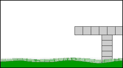
One reason the work was able to do as little disturbance to canyon as possible was because of a construction method never before used in the U.S. Known as balanced cantilever construction, the method works by building a bridge from above, rather than below. A bridge column is first built, and then a special crane known as a gantry is positioned atop the column. The gantry builds the bridge outward from the column using precast segments that are trucked in.
- Balanced Cantilever Construction Demonstration - Animated GIF [104k] - Shows the general process by which some of the bridges in Glenwood Canyon were built.
As construction of Glenwood Canyon progressed, a major problem began to develop in late 1984: Gridlock. There were numerous construction points along US 6 in the canyon, and at each point a contractor would do its own traffic control, starting and stopping traffic with flaggers. There was no coordination between them, and traffic would be released at one point only to have to stop again a short distance later. The time for 16-mile trip through the canyon began to approach 2 hours. So CDH instructed DMJM to begin a traffic management program, which included coordination between contractors, consolidating traffic control under a single authority, outfitting flaggers with radios, and leading convoys of vehicles through the canyon with pilot cars. The program was successful, with traffic having only a single stop in the canyon of 30 minutes.
Construction proceeded by building the lower (eastbound) lanes first, switching traffic to them, and then building the upper (westbound) lanes. Construction would include 39 bridges and viaducts (6.5 miles total) and 3 tunnel bores.
Construction began to wind down in 1992. I-70 through Glenwood Canyon was completed a year ahead of schedule at a cost of $490.3M, 90% of which was federal Interstate funding. The formal dedication was held October 14, 1992 in the eastbound Hanging Lake Tunnel, with Governor Roy Romer cutting the ribbon.
Some photos from retaining wall construction in Glenwood Canyon, all courtesy Michael McMullen:
|
|
|
|
|
|
|
|
|


Use the link above left to continue on to the Guide page, and find what the completed Interstate is like.