|

|
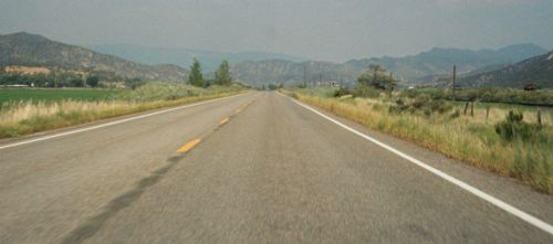
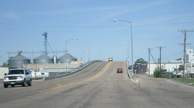
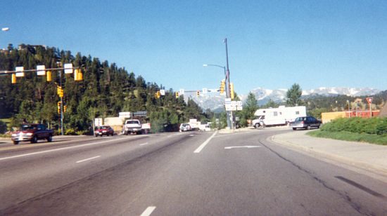
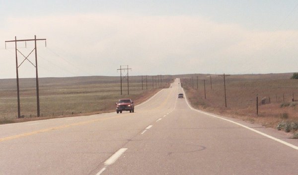
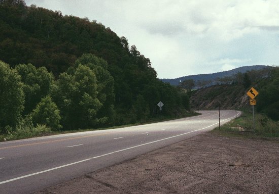
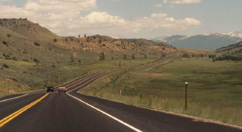
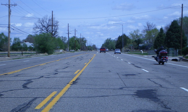
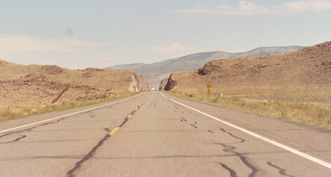
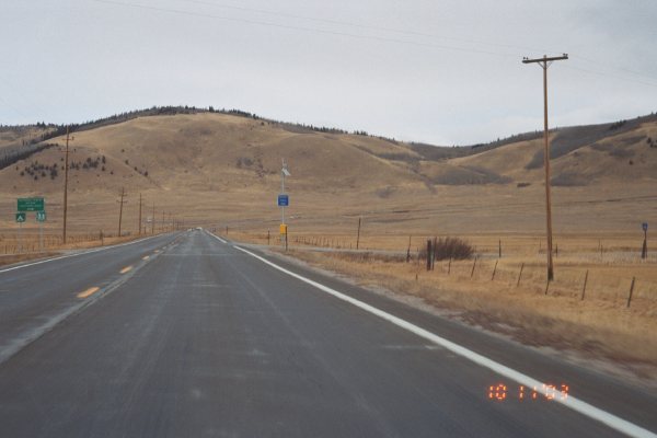
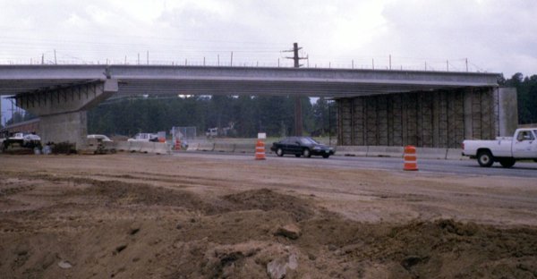
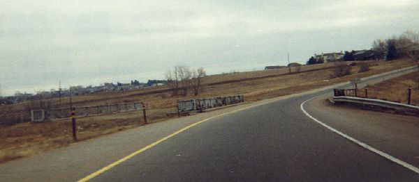
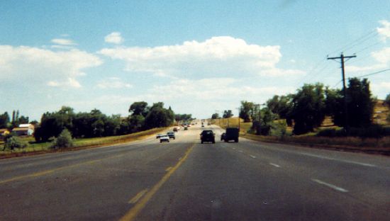
- East of Silt.
Eastbound on US 6 east of Silt. June 2002
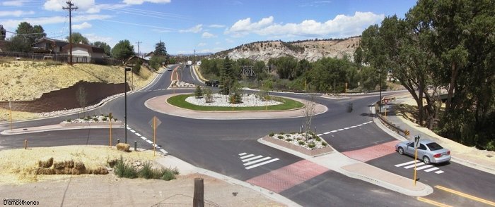
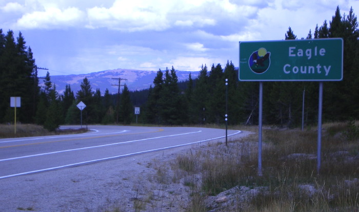
- Eagle Roundabout. Looking west along US 6 at BL 70 on the east side of Eagle. Photo by Phil Demosthenes.
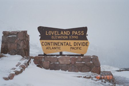
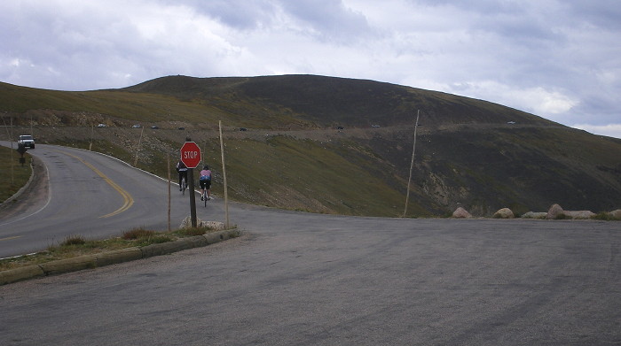
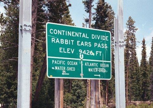
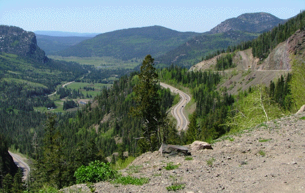
- Loveland Pass
Marker. The US Forest Service marker at the summit
of Loveland Pass. November 2003
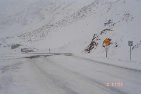
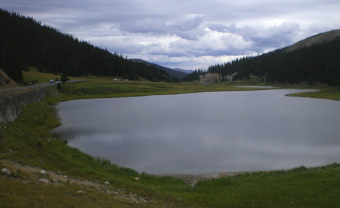
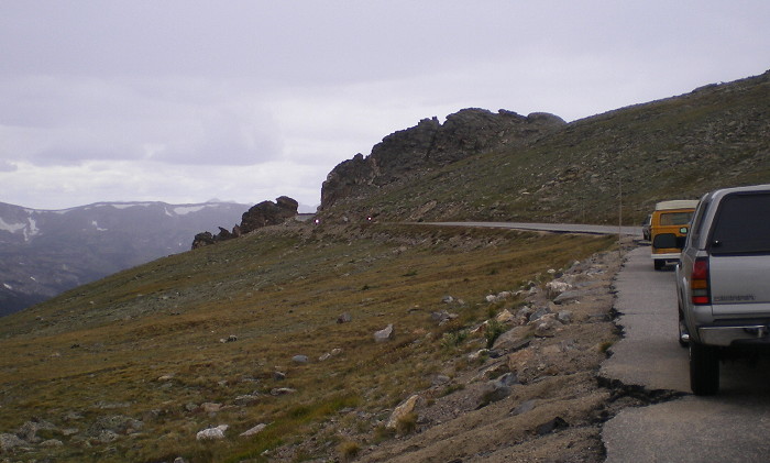
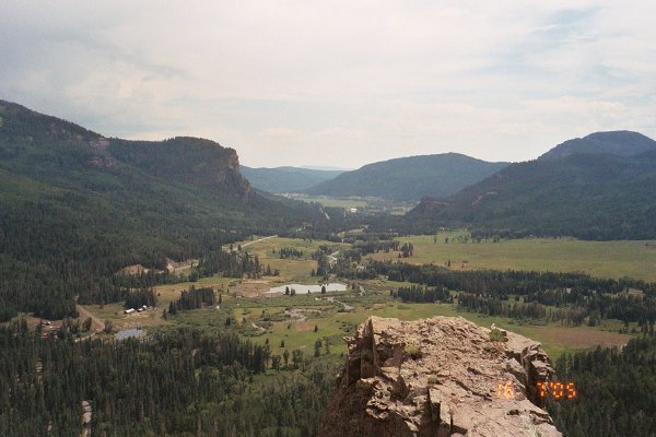
- Loveland Pass
Summit. The view looking from the summit of Loveland
Pass westbound down US 6 during a snowstorm. November 2003
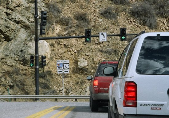
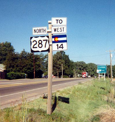
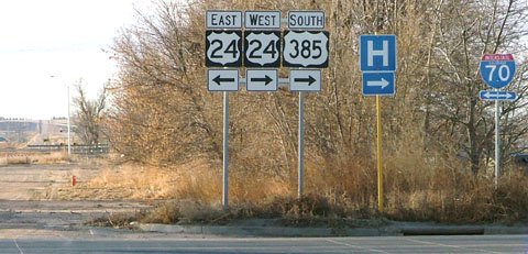
- US 6/SH 119 Intersection. The signs and signals at the T intersection where eastbound US 6 hits SH 119 in Clear Creek Canyon. March 2005
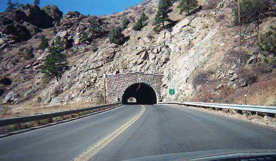
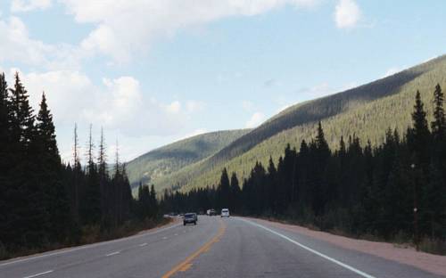
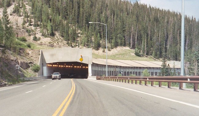
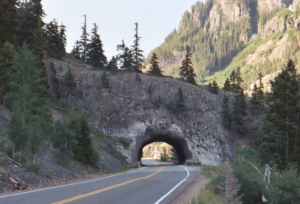
- Tunnel #3. Westbound
on US 6 in Clear Creek Canyon. October 1999
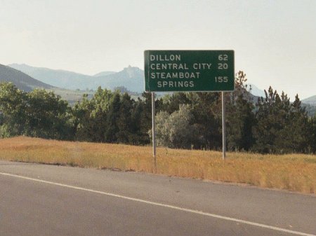
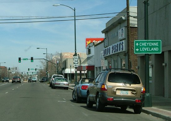
- Bizarre Distance
Sign. Westbound US 6 at 19th Street, Golden. I have
no idea how they could have decided to list the cities on
this distance sign that they do. June 2003
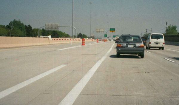
- Skirting Golden's West
Side. The view on westbound US 6 as it's skirting
the west side of Golden between Jefferson County Parkway and
19th Street. June 2003
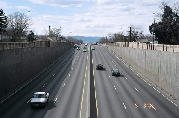
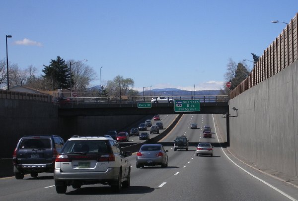
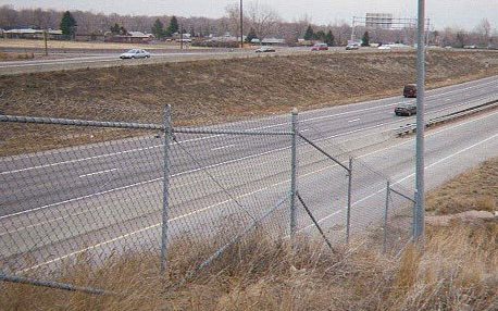
- Perry Street Narrows.
Looking west down onto the 6th Avenue Freeway from the Perry Street
overpass in Denver. This segment of US 6 features no shoulders and 20'
vertical walls just a couple feet from the lanes. March 2005
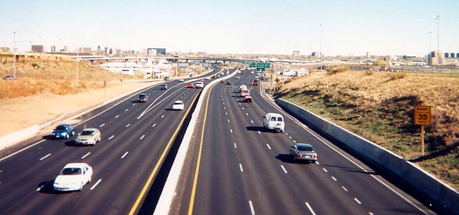
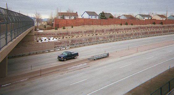
- The 6th Avenue
Freeway. As viewed looking east from the Federal
Boulevard overpass. October 1999
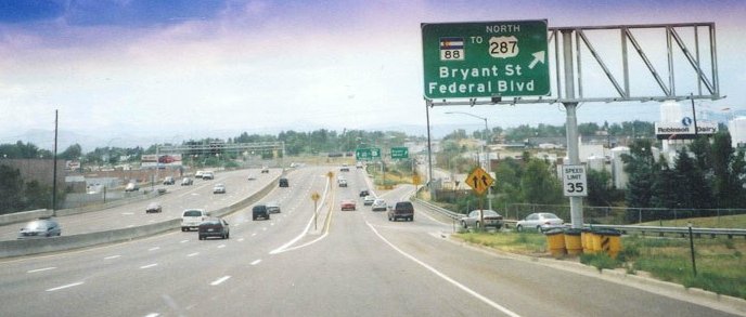
- Federal Onramp/Bryant
Offramp. Voted one of the worst weave sections in
Denver by readers of the Rocky Mountain News, here
someone from Federal (SH 88) getting onto eastbound 6th has
to deal with no acceleration distance and traffic trying to
get off at Bryant. Photo courtesy David Herrera. July 2003
- I-25/Bryant/Federal C-D
Road. Westbound 6th Avenue within the I-25
interchange where one exits to a C-D road system to get to
Bryant or Federal (SH 88). Photo courtesy David Herrera.
July 2003
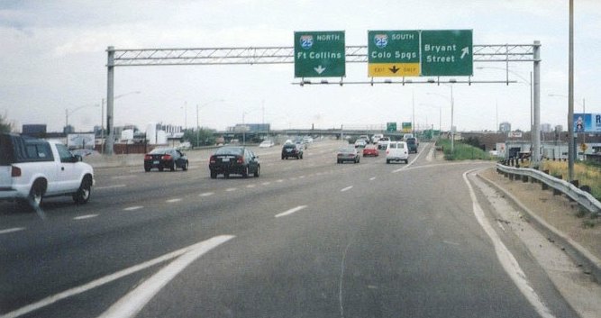
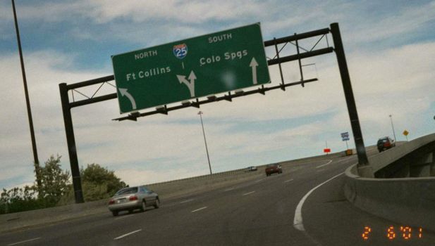
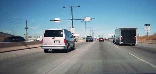
- US 6/I-25. Eastbound on
the C-D road that takes you from US 6 to I-25. June 2001
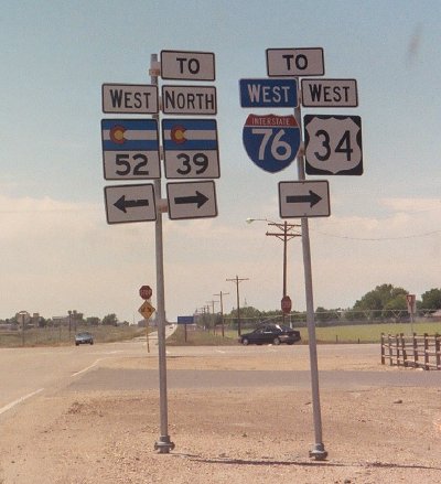
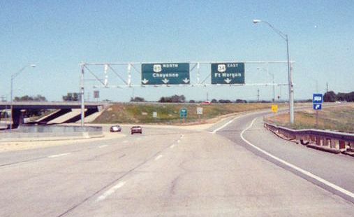
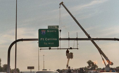
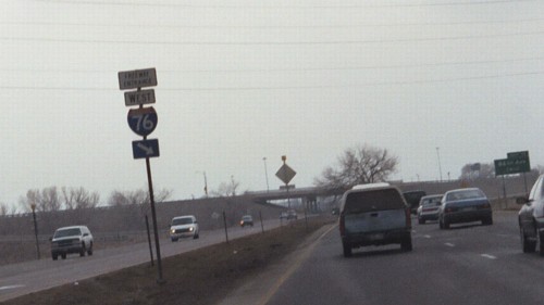
- SH 39/52 Et al Marker Assembly.
A marker assembly on westbound US 6 at SH 39/52 on the east side of
Wiggins. This is within the I-76 Exit 66 interchange complex and these
markers help traffic deal with the odd setup of the area, which
includes an off-interchange rest area. May 2005
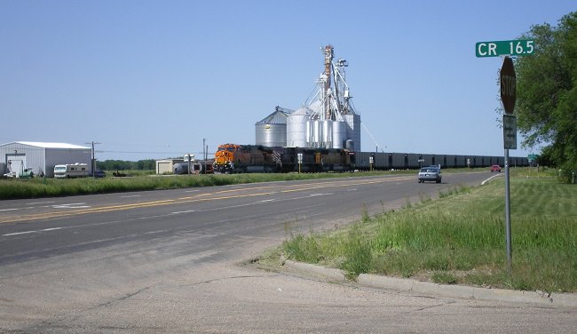
- Atwood BNSF Train. Looking west on US 6 from the SH 63 intersection in Atwood at an empty eastbound BNSF coal train. May 2007
- Division Avenue, Sterling. Eastbound US 6 heading north on Division Avenue in the south side of Sterling. May 2007
- Sterling Begin One-Way Couplet.
Eastbound on US 6 in Sterling, heading north on Division Avenue as it's
about to make the right turn onto 3rd Street. This marks the beginning
of US 6's two one-way streets in Sterling. May 2007
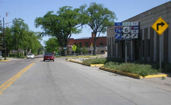
- US 6/SH 14 Intersection. Eastbound on US 6 and SH 14 in Sterling, which happens to be 3rd and Main Streets. May 2007
- Sterling Railroad Viaduct. Looking west on US 6 at the base of the railroad viaduct east of downtown Sterling. May 2007
- Curve West of Fleming. Heading west from Fleming US 6 has this abrupt curve to the left to head southwest toward Sterling. May 2011
- SH 59 Intersection, Haxtun. Sign at the westbound US 6 intersection with SH 59 in Haxtun. May 2011
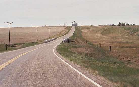
- Central Phillips County. Westbound US 6 through Phillips County with Paoli's grain elevator visible on the horizon. May 2011
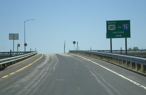
- Holyoke Grain Elevator. The view looking west on US 6 from US 385 in Holyoke, with the grain elevator complex dominating the view. May 2011
|
|
|
|

|
- South of
Minturn. The scenery looking
southeast along US 24, from a pullout between Gilman and Red Cliff. June 2002
- Battle Mountain Ascent.
A shot looking along westbound US 24 just on the north side of Red
Cliff. US 24 begins climbing the side of Battle Mountain higher up the
side of the Eagle River canyon, summitting at Gilman and then dropping
down to Minturn. September 2009
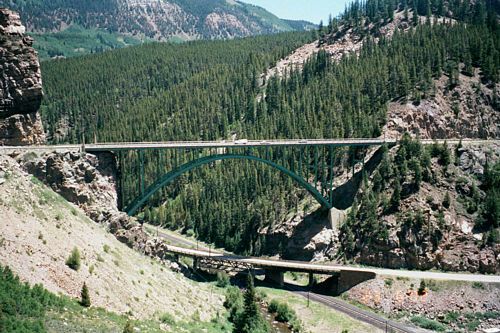
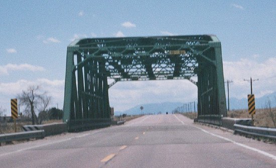
- Red Cliff Arch (Eagle River)
Bridge. A cool picture of US 24's bridge over the
Eagle River near Red Cliff. The plaque on the bridge says
1940. June 2002
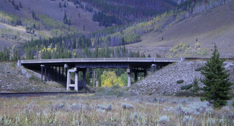
- Pando Bridge.
Built in 1941, this bridge takes US 24 over the UPRR at the former
Pando rail siding. Pando was located at the north end of Camp Hale and
was the railroad service point for the camp. September 2009
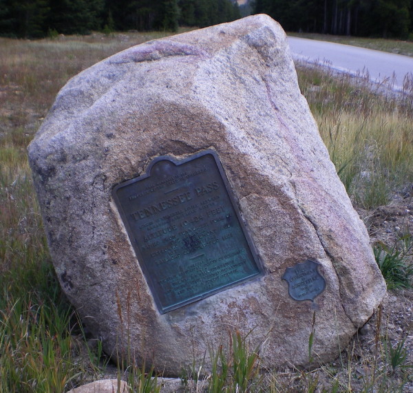
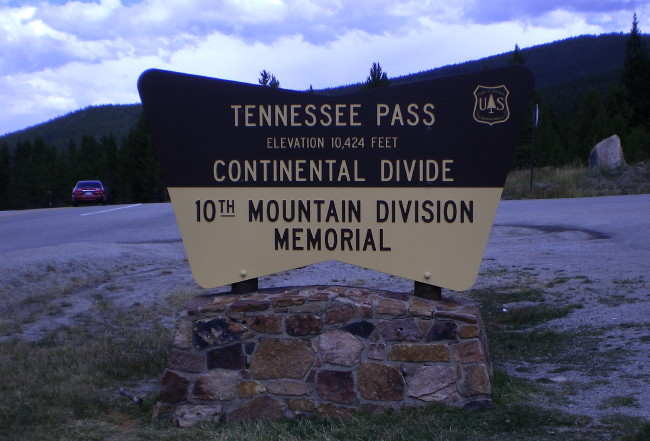
- Top of Tennessee Pass: Westbound • Old Marker • Newer Marker.
The top of Tennessee Pass features a parking area and a memorial to the
10th Mountain Division with a granite slab with the names of soldiers
killed in Europe and the Alaska Kiska campaign during WWII. The old
marker dates from 1929 and features the US shield-shaped symbol for the
Bureau of Public Roads. September 2009
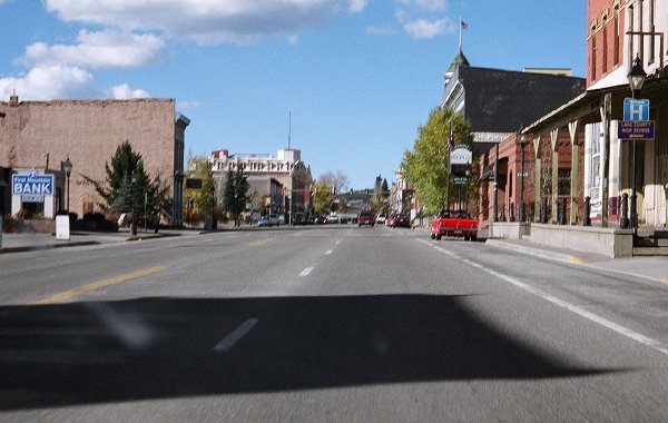
- Downtown Leadville. A shot of US 24 as it travels down northbound Harrison Avenue in historic downtown Leadville. October 2004
- Cutout-Style Marker.
An unusual (for Colorado) cutout shield south of Leadville.
Photo courtesy Robert Halonen.
- California Gulch, South of Leadville, Looking West and Looking East.
US 24 uses California Gulch southwest of Leadville, downstream heading
west. But the directions are reversed, with eastbound US 24 going west
down the gulch and westbound US 24 going east up the gulch. Looking
west you see Mount Massive of the Sawatch Range and the Continental
Divide. Looking east is the Mosquito Range. September 2006
- Kobe Valley.
Located about 5 miles north of SH 82, Kobe is a UPRR rail siding along
the east side of US 24 as it heads through a broad Arkansas River
valley. This view on westbound US 24 looks north toward a rainstorm
that was probably near Turquiose Lake. September 2009
- North of Buena Vista. A view of westbound US 24 as it goes through the Arkansas River canyon north of Buena Vista. October 2004
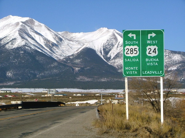
- US 24-285 Split Signs South of Buena Vista, Sign 1 and Sign 2.
These two shots show the signs on westbound US 24-285 approaching the
split south of Buena Vista. The first sign is a little ways before the
intersection, while the second one is nearer to it, and you can see the
T-intersection itself. Both photos by Dale Sanderson. March 2008
- Mount Princeton.
The peak dominates the western horizon in this area, as seen on
westbound US 24-285 a little east of Johnson Village. Photo by Dale
Sanderson. March 2008
- Curves Sharpen. A specific warning sign on westbound US 24-285 as it enters the Trout Creek canyon east of Johnson Village. August 2009
- East of Hartsel. The view on eastbound US 24 as it crosses a broad plain between Hartsel and Wilkerson Pass. June 2005
- East of Wilkerson Pass. Here east of Wilkerson Pass this section of eastbound US 24 features an alpine plain dotted with evergreens. September 2010
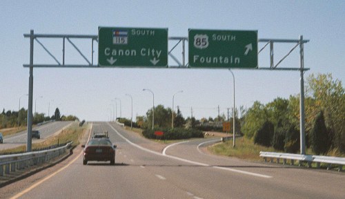
- Woodland Park SH 67 Intersection. The eastbound US 24/SH 67 split features this large destination sign. September 2010
-
Fountain Creek Canyon.
US 24 eastbound descending down Fountain Creek Canyon west of Manitou
Springs. In some places the two roads are on opposite sides of the
creek. June 2005
- Manitou Springs
Split. Eastbound at the split for the business route
to Manitou Springs. January 2001
- Powers
Boulevard. Heading north on the Powers Boulevard
section of US 24 in Colorado Springs south of Airport Road.
September 2003
- Platte/Powers
Interchange. Eastbound on US 24 (northbound Powers
Boulevard) approaching the interchange at Platte Avenue. US
24 exits to head east to Limon. Photo by Russell Kroll. May
2003
- Platte Exits to Powers.
Westbound on US 24/Platte Ave. coming up to the Powers Blvd.
interchange. Note WB US 24 is signed going onto SB Powers, and the
signs have empty space set aside for other markers (SH 21, for when Powers is numbered that). May 2004
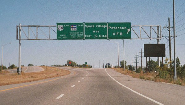
-
Peterson AFB/SH
94. Overhead sign assembly on eastbound US 24 west
of SH 94 at Peterson Air Force Base. September 2003
-
Black Squirrel Creek Truss Bridge.
Westbound on US 24 at an old steel truss bridge over Black Squirrel
Creek at milepost 327 west of Peyton. They don't build bridges like
this anymore. May 2004
-
Ellicott Highway. The scenery westbound on US 24 near Ellicott Highway, east of Peyton. May 2004
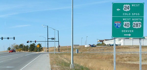
- West Limon
Intersection, Eastbound. At the US 24/Spur 24
intersection in west Limon, on eastbound US 24. Note how
I-70 and BL I-70 get the major treatment on the large sign
while US 24, 40 & 287 are on smaller stand-alone signs
up near the intersection. Photo by Dale Sanderson. December
2003
- West Limon
Intersection, Westbound. Same intersection, but on
westbound US 24. Photo by Dale Sanderson. December 2003
- Limon
Multiplex: Older Markers • Newer Markers. Eastbound
Main St. in central Limon. Five, count 'em, five shields through
downtown. This is actually a "wrong-way" multiplex, because it is East
BL 70, 24, and 40, South 287, and North 71. However, note in the second
picture that CDOT cheats andby omitting the direction for SH 71 doesn't
actually mark it as a wrong-way multiplex. First photo courtesy Robert
Halonen (1998), second photo by me (April 2005).
- End West of
Seibert. Westbound US 24 at CR 12 west of Seibert.
To the left of the picture CR 12 has an overpass over I-70;
no interchange, just a grade separation. This point marks
the west end of state maintenance of the Seibert-Burlington
section of US 24. Photo by Dale Sanderson. December 2003
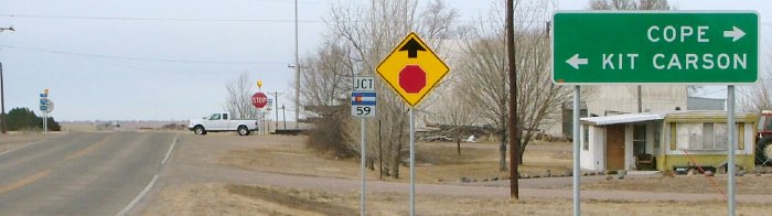
- Jct SH 59, Seibert.
Westbound US 24 approaching SH 59 in Seibert. Photo by Dale
Sanderson. December 2003
- Spring Creek Crossing, East of Vona.
One of the dips US 24 makes down to a creek crossing on the Plains,
here on westbound US 24 at Spring Creek. In the distance is Vona. May
2006
- East Burlington. Westbound on BL I-70 at its junction with US 24 on the east
side of Burlington. Photo by Dale Sanderson. December 2003
|
|
|
|

|
DEFUNCT HIGHWAY
- Colorado Avenue. A
cutout-style US route marker on Colorado Avenue at 25th
Street in Colorado Springs. This section of Colorado Avenue
is no longer part of BR 24. January 2001
|
|
|
|

|
- Rocky Mountain National Park West Entrance. Queued up traffic on US 34 heading east into the park entrance station for the busy Labor Day weekend. August 2008
- Eastbound Up Trail Ridge Road.
This shot shows US 34 heading up the west side of the park, here
between the Colorado River Trailhead and Farview Curve. Note the old
stone guardwall on the side. August 2008
- Milner Pass View of Poudre Lake, Parking Area and Marker Sign. Trail Ridge Road crests Milner Pass and the Continental Divide at 10,758 ft, but still has a ways to go uphill. August 2008
- At the Treeline. Here Trail Ridge Road is about to climb above treeline on the west side of the park, below Medicine Bow Curve. August 2008
- Climbing From the Alpine Visitor Center. Heading east from the Alpine Visitor Center on Trail Ridge Road is still uphill. August 2008
- Gore Range Pullout View West and East. Trail Ridge Road features a pullout east of the Alpine Vistior Center called Gore Range, affording these views. August 2008
- Trail Ridge Road High
Point. In Rocky Mountain National Park. It's 12,183
feet high! July 1998
- Rock Cut Driving Through and View from the East. At one point Trail Ridge Road goes through a rock outcropping that was cut through. August 2008
- Switchbacks.
Looking down on Trail Ridge Road climbing the mountains from
Rainbow Curve. July 1998
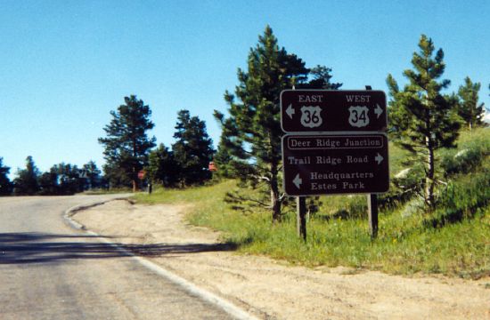
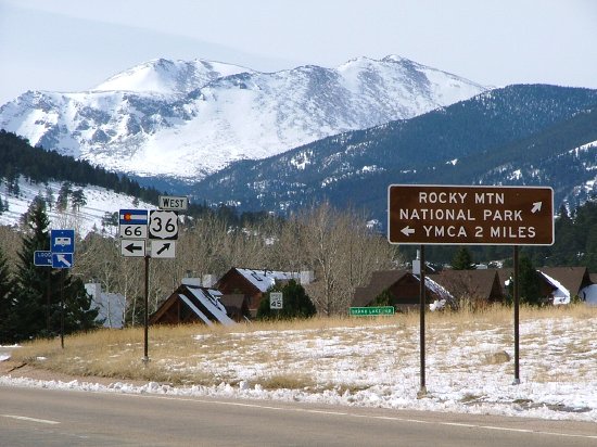
- Deer Ridge
Junction. Westbound on US 34 approaching the
intersection with US 36 in RMNP. July 1998
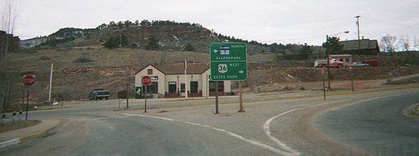
- US 34-36 Intersection in
Estes Park. Another meeting place of the two
highways, as seen westbound on US 34 in east Estes Park.
July 1998
- Big Thompson Canyon
Narrows. Westbound on US 34 west of Loveland. July
1998
- Big Thompson Canyon
Entrance. Westbound entering the canyon, with some
ominous signing. The green thing up ahead is an aqueduct.
December 1997
- Railroad Overpass
Construction. Looking west on US 34 just west of US
287 at construction going on at a BNSF railroad overpass.
Notice anything wrong with the sign? June 1999
- US 34 at Jefferson
Avenue. An overhead sign assembly in Loveland on
westbound US 34 approaching the two intersections with US
287. June 1999
- US 34 Expressway Railroad
Crossing. Eastbound on US 34 east of I-25. July 1998
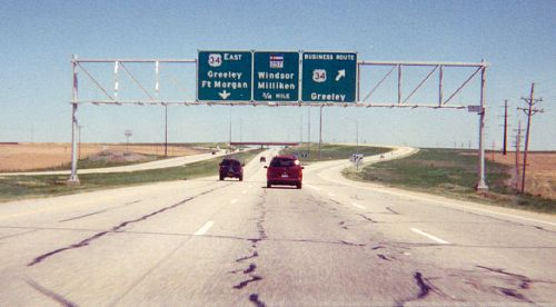
- West US 34/BR 34
Split. Eastbound west of Greeley. Not a very good
picture. June 1999
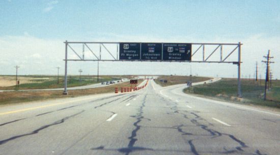
- Same Interchange a Year
Earlier. Construction has changed the signing a
little. July 1998
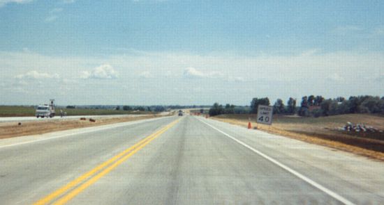
- Expressway
Construction. Eastbound west of Greeley during a
construction project that was widening US 34 from two to
four lanes. July 1998
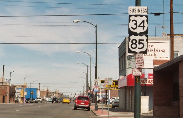
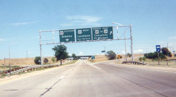
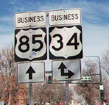
- US 34-85. Eastbound US
34 approaching the interchange with US 85 in south Greeley.
July 1998
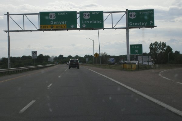
- US 34-85 Part 2.
This time within the interchange, on US 34 eastbound/US 85
northbound. June 1999
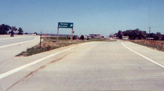
- Kersey Business.
Eastbound where US 34 bypasses Kersey, and old US 34 goes
off to the right. June 1999
- Kersey Frontage Road End and Eastbound.
Old US 34 past Kersey has been turned into a frontage road. One picture
is the western end where the ramp from eastbound US 34 feeds onto it,
and the other picture is eastbound approaching the connector road to
the 34/37 intersection. March 2007
- At SH 37 Eastbound. Eastbound on US 34 at the main intersection at Kersey, SH 37. Photo by Dale Sanderson. March 2007
- Undivided Four Lanes.
A view on westbound US 34 at Milepost 131. This is the 6 mile-long
section of undivided four-lane expressway east of Kersey. The terrain
provides a roller-coaster ride. May 2005
- Through Akron. Eastbound on US 34 looking through Akron. May 2011
- SH 61 Intersection, Otis. View of eastbound US 34 as it's entering Otis, showing the SH 61 intersection and the water tower. May 2011
- Signal at SH 59, Yuma. The intersection on the east side of Yuma with SH 59, as seen on eastbound US 34. May 2011
- Between Eckley and Wray. Scenery on eastbond US 34 east of Eckley. May 2011
- US 385 Intersection, Wray. Eastbound on US 34 at the signal with US 385 on the west side of Wray. May 2006
- Central Wray. Typical smaller-town scene as US 34 heads west through central Wray. May 2006
|
|
|
Greeley
|
- 10th St/10th Ave Turn.
Westbound BR 34 on 10th St, approaching its right turn onto 10th Ave.
BR 34 goes one short block north then turns west on 9th St, with 10th
and 9th forming a one-way couplet. Photo by Dale Sanderson. March 2007
- 10th St Westbound. Westbound BR 34 (10th St) heading away from BR 85 (8th Ave). March 2007
- 10th St/8th Ave Signal Signs. Eastbound BR 34 (10th St) at BR 85
(8th Ave). On the signal mast arm is this sign showing BR 34's right
turn. This looks like something cooked up by the city, not CDOT since
the markers within the sign have an odd shape. March 2007
- 8th Ave/10th St Turn. Northbound BR 34-85 at 10th Street, showing the signs for BR 34's left turn. Photo by Dale Sanderson. March 2007
- BR 34-85 Reassurance Markers.
Northound on BR 34-85 (8th Ave) approaching downtown Greeley. Here
there is this reassurance marker assemply, but the markers have an odd
shape, making me think it was done by the city and not CDOT. March 2007
- 8th Ave/18th St Turn. Southbound BR 34-85 at 19th St, with the signs for BR 34's left turn. Photo by Dale Sanderson. March 2007
|
|
|

|
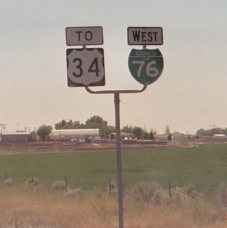
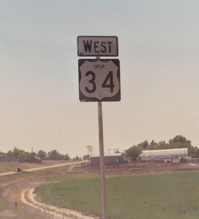
- North End, To 34/West BL 76. The first markers one sees on southbound Spur 34 south of I-76. May 2005
-
North End, West Spur 34.
Immediately after the markers above appears this one. It features
"SPUR" in tiny lettering and marks the spur as an east-west route like
US 34, even though the spur itself is oriented north-south. May 2005
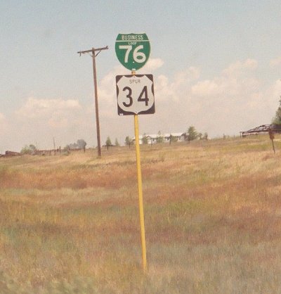
-
South End, BL 76/Spur 34. The markers on northbound Spur 34 just north of US 34. Again there is "SPUR" in tiny lettering. May 2005
|
|
|
|

|
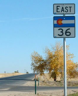
- US 36/SH 66 Estes Park. Westbound on US 36 at SH 66 west of Estes Park. Photo by Dale Sanderson. February 2005
- Jct SH 7.
Westbound on US 36 at SH 7 in Lyons. January 1999
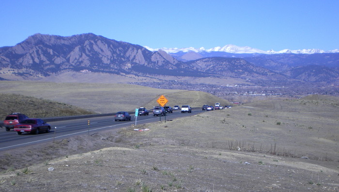
- Davidson Mesa and Flatirons.
A look down westbound US 36 at the Davidson Mesa scenic overlook west
of Louisville. To the left are the Flatirons and Boulder to the right. March 2009
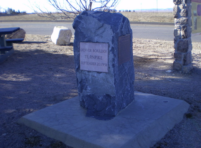
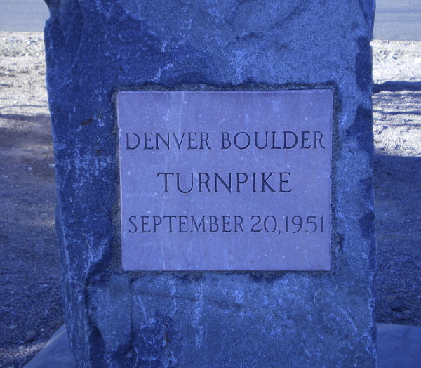
- Denver-Boulder Turnpike Corner Stone: Overview and Closeup.
At the westbound Davidson Mesa scenic overlook, a small memorial has
been set to the Denver-Boulder Turnpike. When it became free in 1967,
the cornerstone from the Broomfield toll plaza was transplanted to
here. March 2009
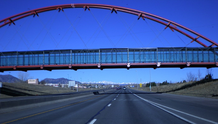
- McCaslin Pedestrian Overpass.
Here's a view on westbound US 36 just west of McCasline Blvd in
Louisville, at a pedestrian overpass. The overpass services the
adjacent RTD park-n-ride and features a steel arch painted red. You
don't see red on bridges around here too much. March 2009
- Denver-Boulder
Turnpike. Looking down on US 36 from the northbound
Federal Boulevard lanes. January 1999
- HOV Gates.
Eastbound US 36 at the entrance to the separated HOV lanes
east of Pecos Street. May 2001
- Overhead Sign
Installation. A shot of workers preparing to put up
an overhead sign needed due to the opening of the eastbound
I-270 extension. This sign about to be installed is on
eastbound US 36 approaching Broadway and is for southbound
I-25. August 2003
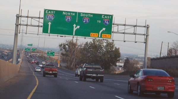
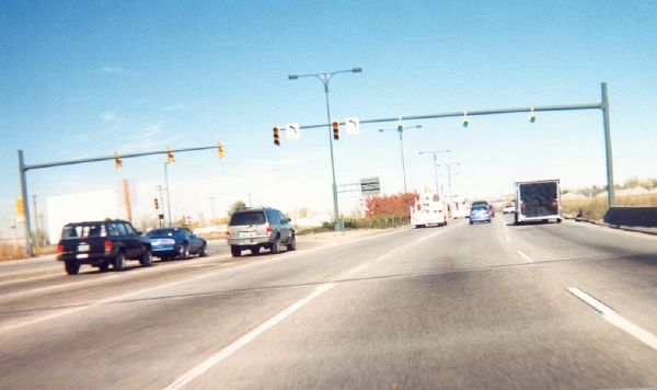
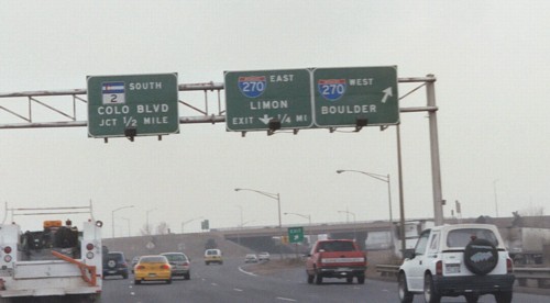
- I-270/I-25 Diagrammatic
Sign. Overhead diagrammatic sign for the unusual
lane layout on eastbound US 36 at I-270/I-25. November 2003
- I-70/US 36 Signs,
Byers. Sign assembly on eastbound US 36 at the
westbound I-70 ramps, Byers. Photo by Dale Sanderson.
October 2003
- Wrong Marker. A
reassurance marker on eastbound US 36 just past I-70.
Problem: It's the state route marker, not US. There's
another marker with the same problem a couple more miles up
the road. The wrong marker has since been replaced since
this picture was taken. Photo by Dale Sanderson. October
2003
- US 36 Curve,
Adams-Arapahoe Line. Westbound US 36 approaching
Byers. This is the curve where US 36 comes off the
Adams-Arapahoe County line (which the road on the right is
running on) to arc down to Byers. Photo by Dale Sanderson.
October 2003
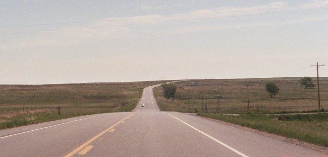
- Different US 36 Curve, Adams-Arapahoe Line.
This curve as US 36 crosses the prairie is on eastbound US 36 14 miles
east of Byers. Here US 36 curves south off of the Adams-Arapahoe County
line and spends about 9 miles in Arapahoe County then curves back onto
the line. May 2006
|
|
|
|

|
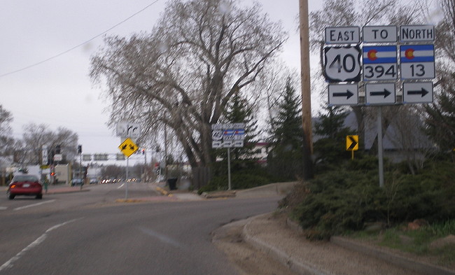
- Craig Eastbound One-Way Split. Signs at the hard right turn where eastbound US 40/SH 13 splits onto its two one-way streets in Craig. May 2008
- SH 394 Intersection, Westbound.
Overhead signs on westbound US 40/SH 13 in Craig approaching the SH 394
intersection. The signs are quite right, since you don't need to be in
the right lane for Maybell/Meeker. May 2008
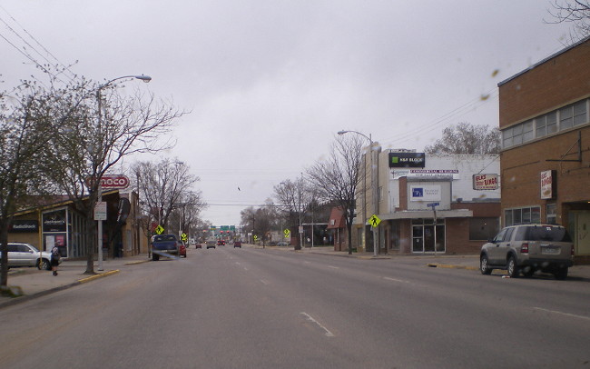
- Westbound in Craig. Shot west along Victory Way in downtown Craig. May 2008
- Westbound at SH 13. Sorta blurry shot of the signs at the intersection in downtown Craig. May 2008
- Lincoln Avenue, Steamboat Springs. Looking northwest along US 40/Lincoln Ave. in downtown Steamboat Springs. May 2004
- English/Metric Speed Limit Sign.
Steamboat Springs' accommodation of international tourists resulted in
this combination sign. It does sort of resemble European speed limit
signs, but with an additional "km/h" below the digits. This sign bucks
traditional practice by giving the limit in something other than a 10
km/h increment. May 2004
- Copper Ridge. Westbound US 40 at High Point Drive in Steamboat Springs, looking out to the Copper Ridge north of town. May 2008
- Rabbit Ears Pass, West Accent. Looking uphill as US 40 climbs the west side of Rabbit Ears Pass. May 2004
-
A good shot of the expansive view US 40 has on the west side of Rabbit
Ears Pass. This is looking down into the very green Yampa River valley
over Lake Catamount. At right middle ground SH 131 heads southwest
toward Oak Creek. May 2004
- A Snowy Drive Over the Pass. A late spring snowstorm heading east over Rabbit Ears Pass. May 2008
- Rabbit Ears Pass Alpine Meadow. A shot looking west along US 40 as it crosses an alpine meadow at the summit of Rabbit Ears Pass. May 2004
- Rabbit Ears Pass Summit Marker.
The utilitarian sign at the summit of Rabbit Ears Pass. More than a few
people have left their marks on it. The steel I-beam posts are new
posts for a new sign to be installed sometime after this picture was
taken. May 2004
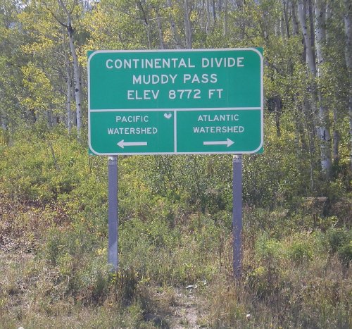
- Muddy Pass Summit Marker. Another utilitarian sign for Muddy Pass, right at the intersection with SH 14. September 2007
- Byers Canyon.
Looking east on US 40 as it enters Byers Canyon west of Hot
Sulphur Springs. What looks like a creek is the Colorado
River. June 2003
- East of Hot Sulphur
Springs. The view of the very green Colorado River
valley looking east on US 40 at milepost 204. June 2003
- South of Granby. The view with Granby off in the distance on westbound US 40 south of town. August 2008
- Tabernash. The
view of the Front Range Mountains (from the west side!) as
US 40 heads east through Tabernash. June 2003
- South of Winter
Park. Westbound on US 40 between the bottom of
Berthoud Pass and Winter Park. Note the second lane for
eastbound traffic. September 2002
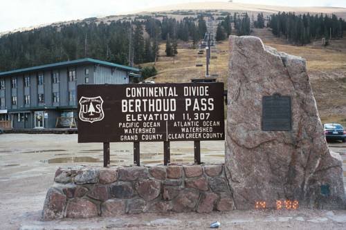
- Berthoud Pass Summit
Marker. The US Forest Service marker at the summit
of Berthoud Pass, in the parking lot for Berthoud Pass Ski
Area. September 2002
- Berthoud Pass Switchbacks
View. Looking from the northwest edge of the
Berthoud Pass Ski Area parking lot down on US 40 snaking its
way down the west side of the pass toward Winter Park.
September 2002
- Berthoud Pass East Side. A view westbound on US 40 going up Berthoud Pass. August 2008
- West of Empire.
Eastbound on US 40 between Berthoud Falls and Empire.
September 2002
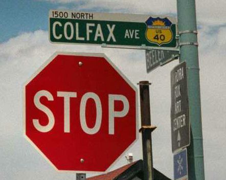
- Colfax Avenue.
Looking west at Locust Street in Denver. May 1999
- Aurora Colfax
Signs. These are the special street name signs
Aurora uses on Colfax. June 2001
- Hugo Two-Lane Concrete.
Westbound on US 40-287 northwest of Hugo. Due to all the truck traffic,
this is a high-grade two-lane road, with concrete, full shoulders,
climbing lanes and rumble strips. May 2004
- US 40 Kit Carson Turn Off. Eastbound US 40-287 at the curve east of Kit Carson where US 40 turns off to head east. May 2011
|
|
|
|

|
- BL 70/US 50 Intersection.
Overhead signs in downtown Grand Junction where US 50 turns off BL 70
at 5th St. The intersection features a double right turn. July 2005
- Southeast of Whitewater. A view of the eastbound US 50 expressway near Lands End Road, Milepost 45. July 2005
- Downtown Delta. Eastbound US 50 at 3rd Street in downtown Delta. US 50 takes a cozy, tree-lined trip through downtown. July 2005
- Downtown Montrose. A view of eastbound US 50 in downtown Montrose, a couple blocks east of the US 550/SH 90 intersection. July 2005
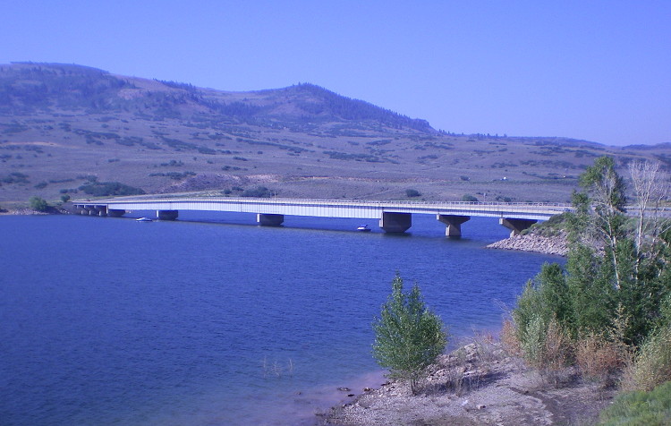
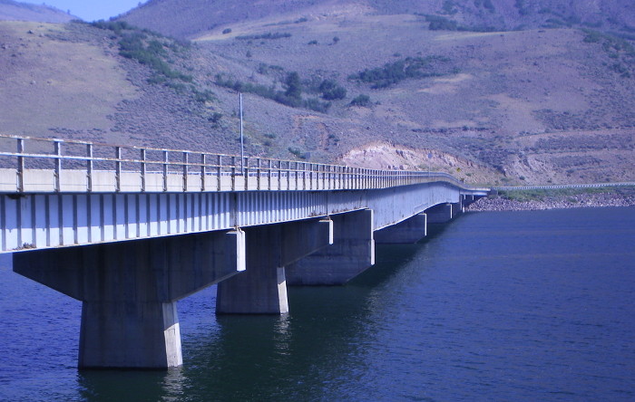
- Blue Mesa Bridge: View West • View North • East Side.
Part way along Blue Mesa Reservoir's length US 50 makes a jump from its
south to north shoreline via a long steel plate girder bridge. August
2009
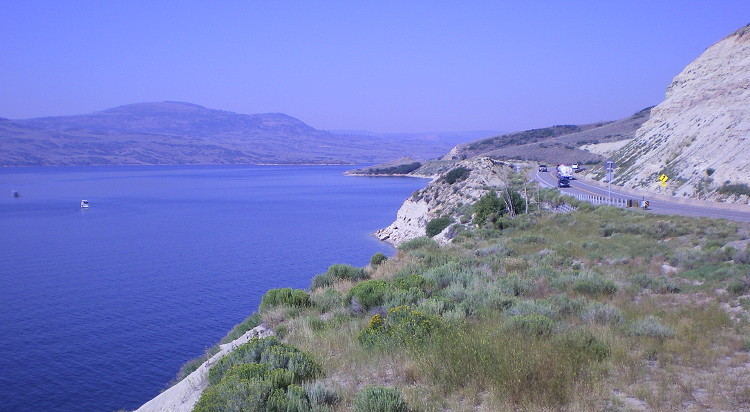
- Blue Mesa Reservoir Shoreline.
US 50 spends a good deal of time near the Blue Mesa Reservoir shore.
This is west of SH 149 as US 50 hugs Blue Mesa's north side. August
2009
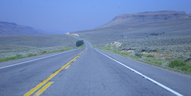
- West of SH 149. Shot on westbound US 50 west of SH 149 in an area where it is not adjacent to Blue Mesa Reservoir. August 2009
- Old Gunnison Truss Bridge: Eastbound • Old and Newer Bridges • Plaque.
On the west side of Gunnison two old truss bridges that used to take US
50 over the Gunnison River still exist, serving a US 50 northside
frontage road now. The second picture shows the old bridge along with
the newer current US 50 off to its south side. August 2009
- West Side of Monarch Pass. Picture looking up US 50 as it climbs the west side of Monarch Pass. August 2009
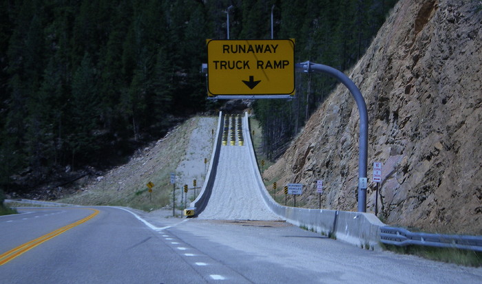
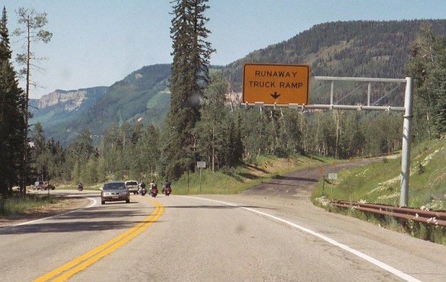
- Monarch Pass Truck Runaway Ramp. Westbound US 50 descending Monarch Pass features one very stout, well constructed truck runaway ramp. August 2009
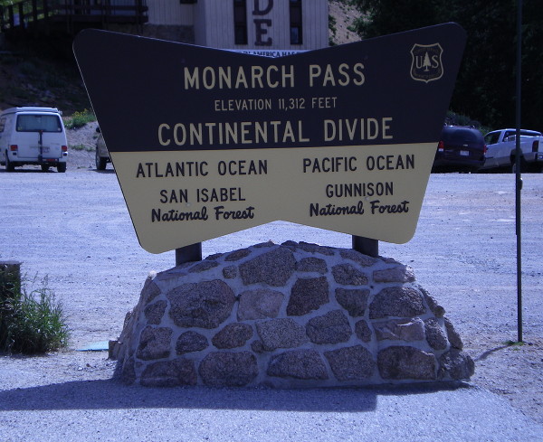
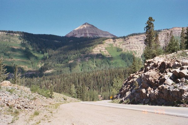
- Monarch Pass Summit View East and Marker. Two shots taken at the top of Monarch Pass, one of the view east and one of the Forest Service marker. August 2009
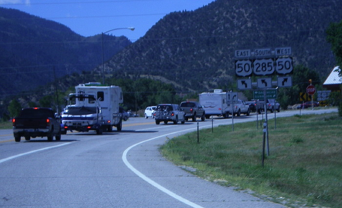
- Poncha Springs Overhead Signs.
A shot of overhead signs on EB/SB US 50-285 approaching the southern
intersection in Poncha Springs where US 50 turns left toward Salida.
September 2004
- East of Salida. Westbound on US 50 about 1 mile east of Salida where it breaks out of the Arkansas River canyon. September 2004
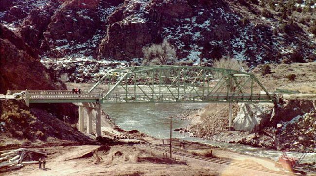
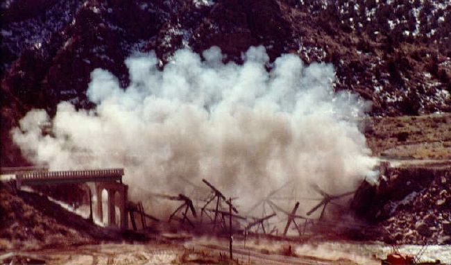
- Arkansas River Bridge Demolition Before
- During -
After.
According to Michael McMullen this bridge near Cañon
City had the end of its truss hit after a truck driver fell
asleep. It happened in very cold weather so there were
brittle fractures in the truss. Since it wasn't certain
where else there were fractures the bridge was demolished
and replaced in a hurry. Photos courtesy Michael McMullen.
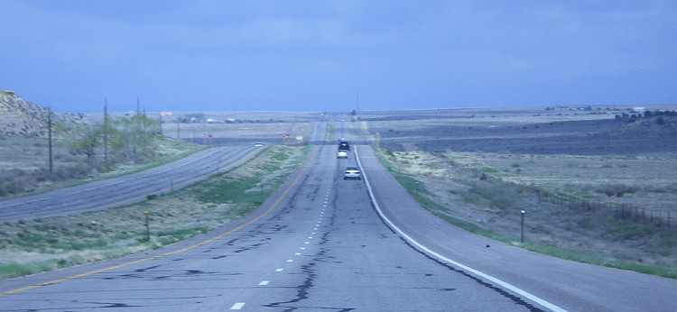
- Where the Deer and Pronghorn Play. Westbound US 50 east of Penrose is a fairly desolate stretch, with just grassy rangeland to look at. May 2009
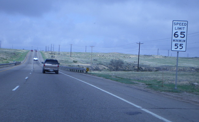
- Minimum Speed 55. US 50 has a 65 mph speed limit with a 55 minimum from the outskirts of Pueblo West east into Pueblo. May 2009
- SH 45 Junction.
Here as westbound US 50 leaves Pueblo its two directions split for the
SH 45 intersection, a layout for a potential future interchange. May
2009
- US 50 Eastbound at
I-25. A shot of a sign on eastbound US 50
approaching the SPUI at I-25 in Pueblo. Traffic is advised
to use SH 47 as a Pueblo bypass. Photo courtesy Steve Riner.
- US 50 Westbound at I-25.
A picture of the huge overhead signs on westbound US 50 approaching
I-25 in Pueblo. Note the overlap of US 50 going onto NB I-25 is well
marked. May 2004
- Destroyed Pedestrian Overpass.
This picture shows a pedestrian overpass east of Troy Ave. in east
Pueblo that was partially destroyed in fall 2003. A truck driver
dropped his lunch pail on the lever raising the bed of the truck, and
the bed hit the bridge as the truck passed underneath. May 2004
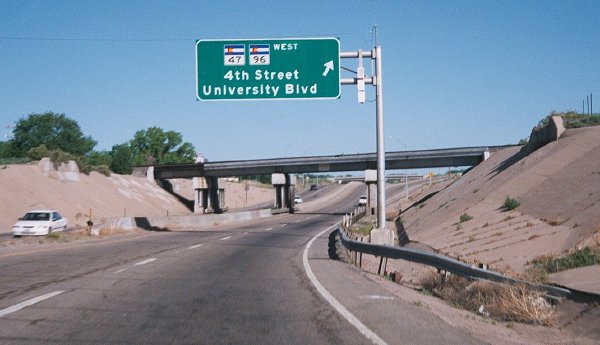
- Westbound at SH 47-96. Overhead signage on westbound US 50 approaching the SH 47-96 interchange on the east side of Pueblo. May 2004
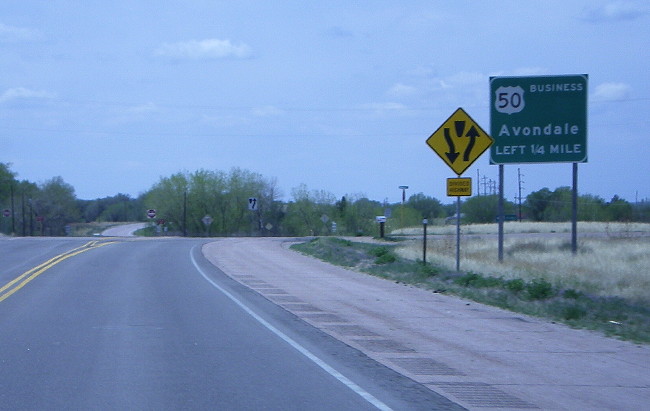
- Westbound Business Junction. Here on westbound US 50 a sign announces the upcoming split for the Pueblo-Avondale business route. May 2009
- Fowler and SH 167 Intersection. Westbound US 50 through Fowler at SH 167. May 2011
- US 50 Manzanola. The view of Manzanola on westbound US 50 at SH 207. May 2011
- US 50 Four-Lane Undivided.
US 50 between Rocky Ford and Manzanola features a four-lane undivided
section sandwiched in between the BNSF line and farm fields. May 2011
- Rocky Ford One-Way Westbound. US 50 westbound through Rocky Ford on the westbound-only Swink Ave near SH 202. May 2011
- SH 71-266 Intersection.
Westbound in Rocky Ford has this marker assembly for the intersection
at SH 71-266. The 266 markers features an extra-wide sign panel. May
2011
- West La Junta Railroad Underpass. On the west end of La Junta US 50 dives down and under the BNSF La Junta-Trinidad rail line. May 2011
- SH 109 Spur Intersection.
Westbound in La Junta this sign points left on Spur 109 for traffic to
get to SH 109, which crosses US 50 on a bridge. May 2011
- Split Alignment East of La Junta.
This view on westbound US 50 east of La Junta shows a segment of
divided highway where the two directions follow different vertical
alignments, with the eastbound side much smoother than the roller
coaster westbound side. May 2011
- Old US 50 Near Las Animas Picture
1 & Picture
2. Two photos of an old concrete section
of US 50 west of Las Animas by Marty Blaise.
- Las Animas, Thompson Boulevard. Westbound US 50 heading west along a tree-lined Thompson Blvd in Las Animas. May 2011
- Las Animas, Bent Avenue. Westbound US 50 heading south on Bent Avenue through central Las Animas. May 2011
- US 50-287, Lamar Intersection Southbound.
Southbound on Main Street in Lamar showing the overhead signs at the
Olive Street intersection. For some reason the US 385 marker includes a
black border around it. May 2011
- US 50-385, Lamar Intersection Eastbound. Eastbound Olive Street in Lamar at Main, with the nice, shiny overhead sign approaching the intersection. May 2011
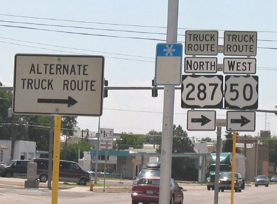
- Truck Route US 50-287.
Westbound on US 50-385 in Lamar approaching 2nd Street. Here two signs
direct truckers onto US 50's truck bypass. The signs here include US
287 since US 50 picks up US 287 heading north out of town. Photo by
Steve Riner. July 2005
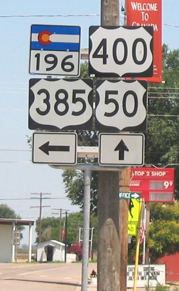
- US 50-385-400, Granada.
A marker assembly on eastbound US 50-385 in Granada. Here US 385 turns
north, while US 400 starts and heads east with US 50. Not sure why they
chose to include SH 196. Photo by Steve Riner. July 2005
|
|
|
Pueblo
|
- Five-Lane Undivided. This shot on eastbound BR 50 shows its five-lane undivided section east of Pueblo. May 2009
- Saint Charles River Mismatched Bridges.
Here BR 50 crosses the Saint Charles River west of Vineland on two
separate bridges. Since the eastbound bridge is newer, it doesn't match
the original through-truss used by the westbound road. May 2009
- Avondale. Eastbound on BR 50 as it goes through Avondale. May 2009
|
|
|

Lamar
|
-
Southbound on US 50-287 approaching Maple St, this sign assembly shows
the start of the eastbound US 50 truck route. The sign includes US 385
since US 50 picks up US 385 heading east out of town. May 2011
-
The truck route includes a turn at Maple and 2nd Streets. This view
shows it looking east on Maple, with the overhead coal conveyors of
Lamar's power plant visible. May 2011
- Truck Route US 50-287.
Westbound on US 50-385 in Lamar approaching 2nd Street. Here two signs
direct truckers onto US 50's truck bypass. The signs here include US
287 since US 50 picks up US 287 heading north out of town. Photo by
Steve Riner. July 2005
|
|
 |
- New Mexico Border. Looking north on US 84 as it enters Colorado. Photo by David Hererra. August 2010
|
|
|
|

|
- Lake Avenue. Northbound former US 85 heading west on
Lake Avenue approaching the interchange with SH 115. This sign is
in error as SH 122 no longer existed at the time the picture was taken. Photo courtesy Russell Kroll. June 2001
- At SH 115
Interchange. Overhead signs on southbound Nevada (former US 85) at the Lake
interchange. Note that to continue on US 85 you had to exit. September 2003
- Santa Fe
Drive. Northbound in Englewood. Shows the HOV lane
on the left side and the overhead assembly with signs and
lights for it. October 1999
- Left Turn to
Hampden. Northbound US 85 at the ramp to westbound
Hampden Avenue (southbound US 285). October 1999
- Evans Avenue SPUI.
Northbound US 85 again, approaching the single-point urban
interchange at Evans Avenue in Denver. October 1999
- Vasquez
Blvd./I-270. Overhead sign assembly on southbound
Vasquez Boulevard (US 85-6) at I-270 in Commerce City.
February 2003
- I-76 Freeway
Entrance. Very unusual signs for Colorado,
southbound on US 85 just past 104th Avenue. From this point
on one can only end up on westbound I-76, hence the signs.
The overpass in the distance is westbound I-76. February
2003
- Typical US 85, Near
Fort Lupton. Southbound on the US 85 expressway
south of Fort Lupton during a light snowstorm. February 2003
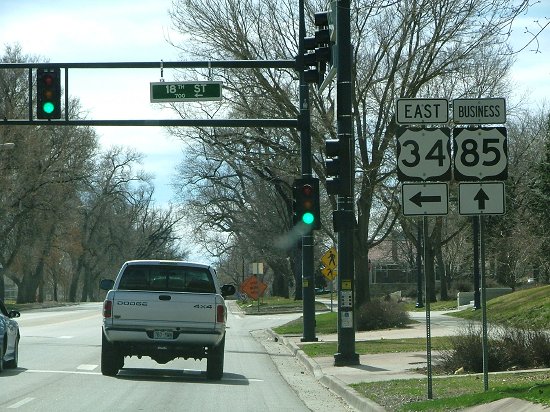
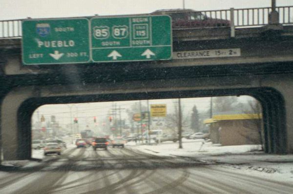
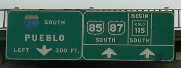
- US 85-34. Northbound US
85 approaching the US 34 interchange in south Greeley. June
1998
- Southbound US 85/Westbound US 34. Within the US 34/85 interchange in Greeley. Pay no attention to the bug smears on the windshield. May 2007
- Southbound Approaching US 34 Interchange. Overhead signs for the four choices drivers have on southbound US 85 approaching the US 34 interchange in Greeley. May 2007
- Business Route 34 Signs. Marker assembly on southbound US 85 at BR 34 (18th St) in Greeley. May 2007
- Southbound at Greeley Business Split.
Southbound US 85 at the business route split north of Greeley. The
interchange is set up so that through traffic has to exit to continue
on US 85. May 2007
- Abandoned US 85-87 Pavement Part
1 and Part
2. Located south of the Interquest Parkway exit
north of Colorado Springs, these two photos show abandoned
pavement from the old US 85-87 expressway before I-25 was
built. Photos courtesy Marty Blaise.
|
|
|
|
Greeley
|
- 8th Ave Southbound. Southbound on BR 85 (8th Ave) coming into downtown at 8th St. Photo by Dale Sanderson. March 2007
- 8th Ave Northbound. Another shot on BR 85, looking north just north of 10th St. March 2007
- 8th Ave/10th St Turn. Northbound BR 34-85 at 10th Street, showing the signs for BR 34's left turn. Photo by Dale Sanderson. March 2007
- BR 34-85 Reassurance Markers.
Northound on BR 34-85 (8th Ave) approaching downtown Greeley. Here
there is this reassurance marker assemply, but the markers have an odd
shape, making me think it was done by the city and not CDOT. March 2007
- 8th Ave/18th St Turn. Southbound BR 34-85 at 19th St, with the signs for BR 34's left turn. Photo by Dale Sanderson. March 2007
- BR 34/BR 85. Marker
assembly on northbound 8th Avenue at 18th Street in Greeley.
January 1999
|
|
|
|

|
NOTE: US 87 is no longer marked in
Colorado. In the late 1990s these were the only signs left:
- I-25/US 85-87/SH
115. Southbound Nevada Avenue at I-25, Colorado
Springs. A neat photo of a vintage button-copy sign. The
sign disappeared in late 2001 as part of an interchange
rebuild. January 2001
- Closeup.
Photo by Russell Kroll. June 2001
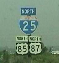
- NB I-25/US 85-87,
Denver. Northbound on I-25 just south of Alameda
Avenue in Denver. This sign no longer exists. Photo by Mike
Ballard.
- NB I-25/US 87,
Denver. Northbound on I-25 south of 58th Avenue.
This sign still is in place. December 1997
|
|
|
|

|
- 4th Street in Sterling. Southwestbound on US 138 along one-way 4th Street in Sterling. May 2007
- North Sterling Expressway. Eastbound on US 138 on a several-mile-long expressway section after leaving the north edge of Sterling. May 2007
- Ackerman Railroad Crossing.
Stopped traffic on westbound US 138 at the Ackerman railroad crossing
northeast of Sterling for a southbound BNSF coal trail. May 2007
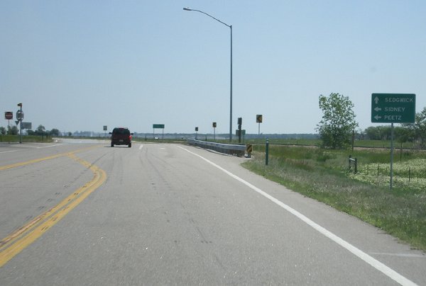
- SH 113 Intersection. Sign on eastbound US 138 at SH 113. Seems to me Peetz should be above Sidney, since it's closer. May 2007
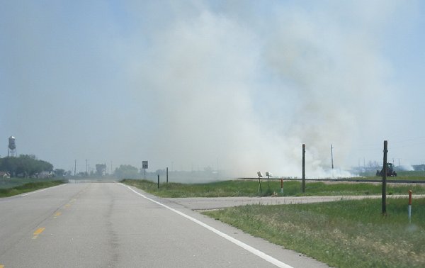
- Burn, Baby, Burn!
Eastbound US 138 approaching Iliff. Here a farmer is doing a clearing
burn along the edge of his field causing lots of smoke. May 2007
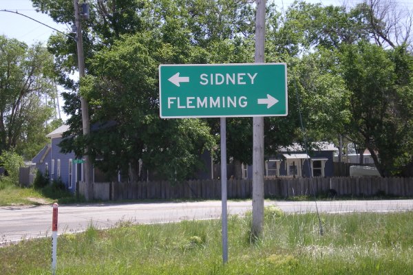
- How Do You Spell "Fleming"? Sign on eastbound US 138 at SH 55 in Crook. Oops, there's an extra "m" in there. May 2007
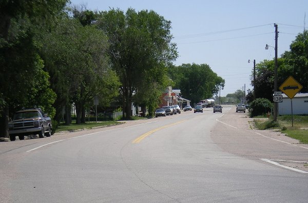
- Crook Main Drag. Looking east down US 138 through Crook. May 2007
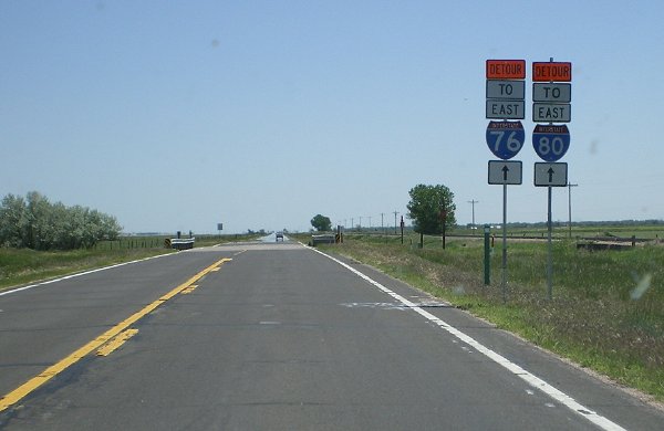
- I-76/I-80 Detour Signs.
Here US 138 has detour signs posted along it due to construction on
I-76. Between Sedgwick and the state line I-76 traffic only had one
lane each direction, so US 138 was signed for the oversize load detour.
May 2007
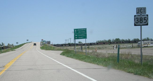
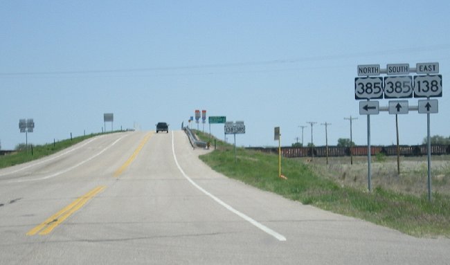
- Approaching US 385. Junction sign for US 385 on eastbound US 138. May 2007
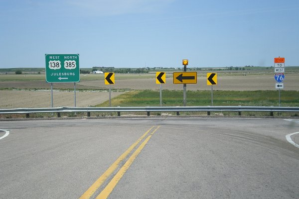
- US 138/385 Marker Assembly. Eastbound on US 138 at the US 385 intersection west of Julesburg. May 2007
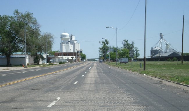
- Julesburg Eastbound. US 138-385 heading eastbound through Julesburg. May 2007
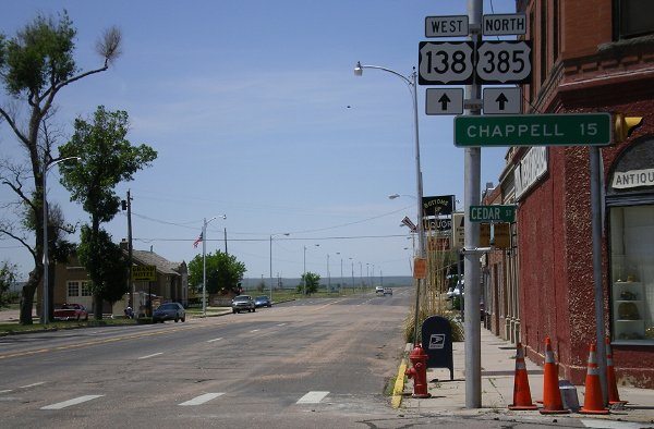
- Julesburg Westbound, Heading to Chappell. Right in the middle of Julesburg heading west is this group of signs, with the distance to Chappell curiously given. May 2007
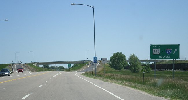
- Exit to US 385 South.
Eastbound on US 138-385 leaving Julesburg. Here is the exit sign for
the US 385 interchange. The interchange features a one-span bridge over
US 138. May 2007
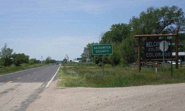
- Nebraska Border. Looking west along US 138 into Colorado at the Nebraska border. May 2007
|
|
|

|
- SH 41 Intersection. Eastbound US 160 at the SH 41 intersection, a mere 4 miles from the New Mexico border. Photo by Adam Froehlig. August 2005
- SH 172 Signs. Overhead signs on eastbound US 160 at SH 172, east of Durango. July 2005
- East of Bayfield. The scenery on eastbound US 160 at Milepost 105, a few miles east of Bayfield. July 2005
- Pagosa Springs. Eastbound US 160 in central Pagosa Springs. July 2005
- Milepost 154, Sheep Mountain.
Here's a shot on eastbound US 160 at Milepost 154, just south of the
Archuleta/Mineral County line. Off in the distance is Sheep Mountain,
while in the right middleground is the formation known as Indian Head. July 2005
- West Fork San Juan River Valley & Indian Head.
Looking southwest from an overlook at Milepost 160, after US 160 has
begun climbing the west side of Wolf Creek Pass. US 160 can be seen
winding its way through the valley below, and at left is another
perspective of the Indian Head formation. July 2005
- Multiple Levels of Wolf Creek Pass.
A little further up Wolf Creek Pass, here multiple levels of US 160 can
be seen, as well as the Indian Head formation. Photo by Dale Sanderson. May 2008
- Four Lanes Up Wolf Creek Pass.
Eastbound US 160 at Milepost 163, climbing up the west side of Wolf
Creek Pass. Note the four lanes, which US 160 has for the entire length
of the grade on the west side of the pass. July 2005
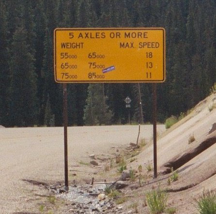
- Truck Advisory Speeds. Because of the almost 7% grade down Wolf Creek Pass, CDOT
has posted a sign with advisory speeds for trucks at the summit. But
what's unusual about it is it lists 3 different weight classes and
progressively slower speeds. July 2005
- Snowshed.
Here's a view on eastbound US 160 of the snowshed on the east side of
Wolf Creek Pass. It provides protection for the highway at an avalanche
chute. The snowshed is in a somewhat awkward place, right at a sharp
25mph curve, prompting lots of warning signs. July 2005
- Tunnel and Old Road.
A shot on eastbound US 160 showing the tunnel at Milepost 174. The
tunnel bypasses a particularly narrow and windy section of the Pass
Creek canyon, which can be seen going down the old road to the left. July 2005
- Narrow Canyon Work.
Milepost 175 on eastbound US 160. Here rock excavation work is going on
in the narrow part of the South Fork Rio Grand canyon to widen the
shoulders. July 2005
- West Alamosa One-Way Split.
Here, with ominus clouds in the sky, eastbound US 160-285 enters the
one-way split on the west side of Alamosa. EB goes onto 6th St ahead
while WB is coming off Main St to the left. August 2010
- At 285, Eastbound. Signs on eastbound US 160-285 where 285 turns south out of Alamosa. August 2010
- At 285, Westbound. Signs on westbound US 160 at the US 285 intersection in Alamosa. August 2010
- Downtown Alamosa. A look west along Main St at San Juan Ave. Shows US 160's one-way westbound only stretch along Main St. August 2010
- Pre-One Way. Looking west along US 160 at State Avenue before the one-way conversion was done. July 2005
- Alamosa One-Way Right Turn. The signal and signs on westbound US 160 as it turns right from Denver Ave to one-way Main St in Alamosa. August 2010
- Rio Grande Bridge, Alamosa. A look a the bridge that takes US 160 over the Rio Grande on the east side of Alamosa. July 2005
- Blanca. The view on US 160 as it passes west through Blanca. August 2010
- SH 159 Intersection. Westbound at the intersection with SH 159 in Fort Garland. August 2010
- East of Fort Garland. Westbound on US 160 between La Veta Pass and Fort Garland. Very dry terrain. August 2010
- La Veta Pass West Descent. Westbound US 160 as it descends the west side of La Veta Pass into the San Luis Valley. August 2010
- (North) La Veta Pass Summit: Markers • View East • View West. A series of pictures on US 160 at the top of La Veta Pass. The view east shows Mount Maestas towering high. August 2010
- La Veta Pass East Side Climb. Westbound US 160 as it begins climbing La Veta Pass. August 2010
- Mount
Maestas. A view looking north from US 160 toward
Mount Maestas, between SH 12 and North La Veta Pass. Photo
courtesy David Herrera. July 2003
- Approaching SH 12. Westbound on US 160 as it comes up to the SH 12 intersection near La Veta. August 2010
- 7th Street Right Turn. Signal and signs on Walsen Ave at 7th St, where US 160 makes its turn off of BL 25 to head west. August 2010
- Walsenburg Business Loop. Southbound BL 25 and westbound US 160 on Walsen Avenue. August 2010
- I-25/US 160 Overlap. Oversized marker assembly showing the I-25/US 160 overlap, just north of Trinidad. August 2010
- Majorly Wide Marker Assembly.
Eastbound at the I-25 Exit 15 interchange, where US 160 turns east off
the freeway. It continues ahead on Kit Carson Trail, but before that
this ridiculously wide marker assembly lets you know what else is going
on here at the intersection. Seems there's some way they could've
gotten the banners and arrows to line up with the markers. August 2010
- Trinidad Kit Carson Trail Turn. Westbound on US 160 on the east side of Trinidad where it turns onto the Kit Carson Trail bypass to I-25. August 2010
|
|
|
|

|
- New Mexico Border: Welcome Sign • Fenceline East.
Here at the New Mexico border is one of CDOT's large welcome signs.
From the road the fenceline at the border stretches off across the
valley. August 2010
- Another View North.
Northbound on US 285, with the
expansive San Luis Valley filling the camera. Photo by David Herrera. February 2007
- South Toward the Volcano.
The view on US 285 as it heads south from SH 17 toward New Mexico.
Filling the windshield is 10,908' San Antonio Mountain, one of northern
New Mexico's numerous extinct cinder cone volcanoes. August 2010
- Approaching Turn at SH 17. Southound US 285 on the south side of Antonito, where US 285 has to turn toward the New Mexico border. August 2010
- Antonito. Southound on US 285 as it passes through Antonito. August 2010
- South of Alamosa.
A view of the Crestone group of peaks, including the Crestone Needle
and Mount Cleveland, from northbound US 285 about 7 miles south of
Alamosa. Photo by David Herrera. May 2005
- US 160-285, Eastbound Turn. Signs on eastbound US 160-285 where 285 turns south out of Alamosa. August 2010
- West Alamosa One-Way Split.
Here, with ominus clouds in the sky, eastbound US 160-285 enters the
one-way split on the west side of Alamosa. EB goes onto 6th St ahead
while WB is coming off Main St to the left. August 2010
- Monte Vista Sign Assembly. Shot of the sign assembly on southbound US 285 at the US 160/SH 15 intersection in Monte Vista. July 2005
-
Rock Cut South of Saguache.
On northbound US 285 south of Saguache at Milepost 83. Here US 285 goes
through a series of rock cuts. In the distance are the hills that mark
the northwest edge of the San Luis Valley. July 2005
-
US 285/SH 17 Destination Sign.
Here's the large destination sign CDOT provides marking the turnoff to
SH 17 from southbound US 285, south of Villa Grove. July 2005
- Mount Shavano.
The view looking north along US 285 between Mineral Hot
Springs and Poncha Springs. The is the northern part of the
San Luis Valley and off in the distance is Mount Shavano in
the Sawatch Range. Photo by David Herrera. March 2002
-
San Luis Valley and Blanca Group.
A shot along southbound US 285 at Milepost 112, about 7 miles south of
Poncha Pass. This shot shows the view looking south across the north
part of the San Luis Valley. Off in the distanace is the Blanca Peak
Group. Photo by David Herrera. May 2005
-
Poncha Pass, North Side.
Here's a picture on northbound US 285 on the north side of
Poncha Pass. At this point the road is oriented west toward Mount
Ouray. Photo by David Herrera. May 2005
- Poncha Springs Overhead Signs.
A shot of overhead signs on EB/SB US 50-285 approaching the southern
intersection in Poncha Springs where US 50 turns left toward Salida.
September 2004
- Southbound US 50 Approach.
View of the marker assembly and traffic waiting to turn left as US 285
southbound comes to US 50 in Poncha Springs. August 2009
- Nathrop Overhead Pipe Crossings.
US 285 features several sets of overhead pipe crossings near Nathrop.
This show shows a series of three as viewed southbound. August 2009
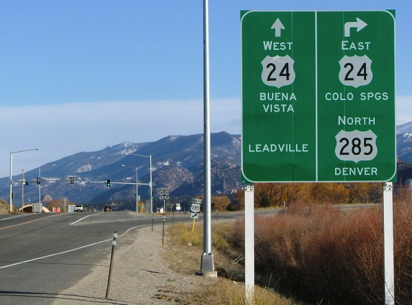
- US 24 Approach Sign South of Buena Vista.
This is the large sign on northbound US 285 approaching US 24 south of
Buena Vista. They really crammed things onto this narrow sign,
resulting in some odd line spacing. Photo by Dale Sanderson. March
2008
- US 24-285 Split Signs, Sign 1 and Sign 2.
These two shots show the signs on westbound US 24-285 approaching the
split south of Buena Vista. The first sign is a little ways before the
intersection, while the second one is nearer to it, and you can see the
T-intersection itself. Both photos by Dale Sanderson. March 2008
- Mount Princeton.
The peak dominates the western horizon in this area, as seen on
westbound US 24-285 a little east of Johnson Village. Photo by Dale
Sanderson. March 2008
- Curves Sharpen. A specific warning sign on westbound US 24-285 as it enters the Trout Creek canyon east of Johnson Village. August 2009
- North of
Fairplay. The scenery during a light snowstorm as
northbound US 285 traverses the South Park valley north of
Fairplay. November 2003
- North of
Jefferson. More scenery on northbound US 285 north
of Jefferson just before it begins to climb up Kenosha Pass.
November 2003
- Kenosha Pass South Park Overlook.
Looking southward into the South Park valley from the Kenosha Pass
overlook. In the middle of the plain is the town of Jefferson.
September 2006
- Kenosha Pass Summit. Looking southbound on US 285 at the Kenosha Pass summit during apsen season. September 2006
- Aspen Park Overpass Part
One and Part
Two. Pictures of an overpass under construction in
Aspen Park. August 2001
- Construction East of
Aspen Park. Widening occurring on US 285 east of
Aspen Park. May 1999
- Windy Point Retaining Wall Part
1 and Part
2. Two shots of the retaining wall at the
massive Windy Point cut east of Aspen Park. The huge cut
into the hillside was necessary as part of the US 285
expressway upgrade. November 2003
- Unusual C-470
Signs. Westbound on US 285 at the SH 470 cloverleaf.
The overhead signs here are unusual in that they don't use
directions for SH 470, instead what highways they head to
(I-70 for WB 470, I-25 for EB 470). Photo by Drew Willsey.
July 2003
- Simms Street
Overpass. Westbound US 285 at the Simms Street
interchange. When the photo was taken the new interchange
had not yet opened. Photo by Drew Willsey. July 2003
- Simms Street Again.
Eastbound US 285 at Simms Street. By the time this picture
was taken the interchange was open. When on this section of
US 285 you're pointed right at the downtown Denver skyline,
which can be seen behind the overpass. November 2003
- Raleigh Street
Overpass. US 285's overpass over Raleigh Street,
adjacent to Bear Creek Park east of SH 95. May 2002
|
|
|
|

|
- US 287-385 at US 50.
Northbound on Main Street in Lamar, there aren't any overhead signs
like the other two directions, just this marker assembly on an extra
tall pole. May 2011
- US 50-287, Lamar Intersection Southbound.
Southbound on Main Street in Lamar showing the overhead signs at the
Olive Street intersection. For some reason the US 385 marker includes a
black border around it. May 2011
- Southbound at US 50 Interchange.
US 287 at the US 50 interchange, with overhead signs showing the
choices. Oops! US 287 wasn't included on the 50 East sign. May 2011
- US 40 Kit Carson Turn Off. Eastbound US 40-287 at the curve east of Kit Carson where US 40 turns off to head east. May 2011
- Hugo Two-Lane Concrete.
Westbound on US 40-287 northwest of Hugo. Due to all the truck traffic,
this is a high-grade two-lane road, with concrete, full shoulders,
climbing lanes and rumble strips. May 2004
- 120th Avenue/Federal
Boulevard. The ramp that takes southbound US 287
traffic from eastbound 120th to southbound Federal. The
bridge appears to be wide enough to have previously carried
traffic in both directions. January 1999
- US 287/SH 121.
Southbound on US 287 at the SH 121 interchange. May 1999
- Lafayette Bypass.
Looking down on the US 287 Lafayette Bypass from the Emma
Street overpass. January 1999
- Berthoud
Construction. Work south of Berthoud on the widening
project. Here's a bypass going around a bridge work area.
January 1999
- Fort Collins-Loveland
Expressway. Southbound on the five-lane expressway
south of Fort Collins. June 1998
- US 287/To SH 14.
Northbound on US 287 north of Fort Collins. June 1998
- Laporte Bypass South
End. Northbound on US 287 where the Laporte Bypass
starts. Photo by Mike Ballard.
- Headlights Test
Section. Two separate signs in the same image
showing the headlights test section on US 287 past Laporte
and Ted's Place. June 1998
- Old US 287. An old
section of US 287 south of Owl Canyon. June 1998
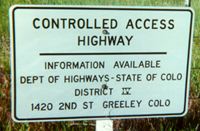
- Controlled Access.
These signs line the right of way fence along US 287 all the
way from Laporte to Wyoming. June 1998
- Suicide Lane.
Looking south on US 287 at CR 37 south of Virginia Dale,
showing the center lane that can be used for passing in both
directions. June 1998
- Dale Creek
Bridge. Northbound just north of Virginia Dale at
the bridge over Dale Creek. This is at the point topography
changes from plains to rocky. Photo by Mike Ballard.
- Colorful Colorado.
The state's welcome sign at the Wyoming border. July 1999
|
|
|
|

|
- US 287-385 at US 50.
Northbound on Main Street in Lamar, there aren't any overhead signs
like the other two directions, just this marker assembly on an extra
tall pole. May 2011
- US 50-385, Lamar Intersection Eastbound. Eastbound Olive Street in Lamar at Main, with the nice, shiny overhead sign approaching the intersection. May 2011
- Southbound at US 24,
Burlington. Marker assembly on southbound on US 385
at the intersection with US 24 on the east side of
Burlington. Photo by Dale Sanderson. December 2003
- South Fork of the Republican River Floodplain.
Here southbound US 385 crosses the South Fork of the Republican River
north of Burlington. From here all the way to the start of the hill in
the distance is the floodplain for the river, prompting CDOT to install
a flash-flood warning system. May 2006
- Black Wolf Creek.
A picture on southbound US 385 south of Wray where it crosses the
valley for Black Wolf Creek. Atop the hill in the distance is the
prevailing elevation for the land in the area. May 2006
- Purple-ish Pavement North of Wray. Crossing the prairie north of Wray, US 385 features this segment with pavement that is faintly purple. May 2011
- High Plains Highway.
US 385 from Cheyenne Wells to Julesburg is the High Plains Highway.
This marker is on the US 385 post as you leave Holyoke. May 2011
- Holyoke Northbound. US 385 south of US 6 in Holyoke has this four-lane tree-lined section. May 2011
- Interocean Drive. This sign on the signal at the US 6 intersection in Holyoke advertises US 385's curious street name through town. May 2011
- Frenchman Creek Bridge. As US 385 comes south into the north side of Holyoke it crosses this old bridge over Frenchman Creek. May 2011
- Northbound US 385 Left Turn at US 138 Interchange.
US 385 has a diamond interchange at US 138 in Julesburg. Here
northbound US 385 reaches the ramps on the north side of the diamond
and turns left down the ramp westbound in Julesburg. May 2007
- Exit to US 385 South: Exit Sign and Right Turn.On
eastbound US 138-385 leaving Julesburg, southbound US 385 exits to its
diamond interchange and then turns right at the top of the ramp to head
south. May 2007
- Julesburg Eastbound. US 138-385 heading eastbound through Julesburg. May 2007
- Julesburg Westbound, Heading to Chappell. Right in the middle of Julesburg heading west is this group of signs, with the distance to Chappell curiously given. May 2007
|
|
|
|

|
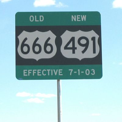
- Old US 666, New US
491. A sign on SH 141 advising of the then-upcoming
renumbering. Photo by Steve Riner. June 2003
|
|

|
- US 160-550 Markers. A marker assembly on southbound US 550 approaching US 160 on the south side of Durango. July 2005
-
Runaway Truck Ramp. A runaway truck ramp on southbound US 550 at Milepost 52, on the descent from Coal Bank Pass. July 2005
-
Engineer Mountain.
A view looking along southbound US 550 as is goes down the south side
of Coal Bank Pass. The peak in the distance is Engineer Mountain, which
dominates the skyline in this area. July 2005
-
North of Coal Bank Pass. A view of US 550 descending down the north side of Coal Bank Pass. July 2005
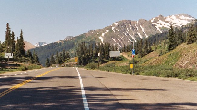
-
Red Mountain Pass Marker. The US Forest Service marker at the top of Red Mountain Pass. July 2005
-
Red Mountain Pass Summit. The view looking south along US 550 from the top of Red Mountain Pass. July 2005
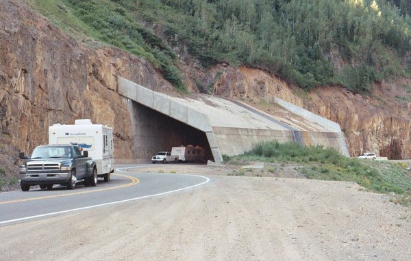
-
Snowshed.
Here US 550 passes through a snowshed, a structure that provides
avalanche protection in the winter. When this picture was taken there
was still snowmelt going on, because an active stream was flowing over
the top of the snowshed. July 2005
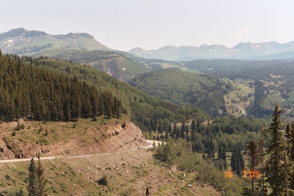
-
Mountainside Shelf Road.
A view looking north in the Uncompahgre River canyon at Milepost 90.
This shows how US 550 had to be blasted into the mountainside to make a
shelf for the road. July 2005
-
Hard Rock Tunnel. An unlined hard rock tunnel, as viewed on southbound US 550 a couple miles south of Ouray. July 2005
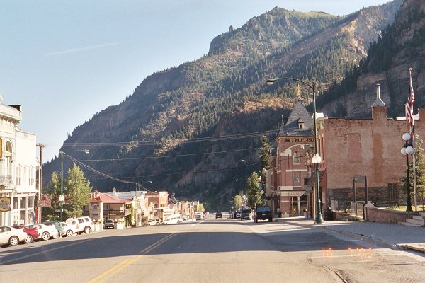
-
Ouray. A good view of Ouray, looking north on US 550 as it passes through town. July 2005
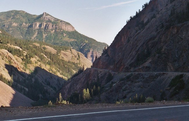
-
North of Ouray.
Southbound US 550 at Milepost 98, a few miles north of Ouray, as the
canyon for the Uncompahgre River begins to rapidly narrow. July 2005
-
Milepost 116. Southbound US 550 south of the Montrose/Ouray County line, with the San Juan Mountains looming on the horizon. July 2005
|